


Reconstructing the geological scenario of Valais
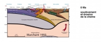
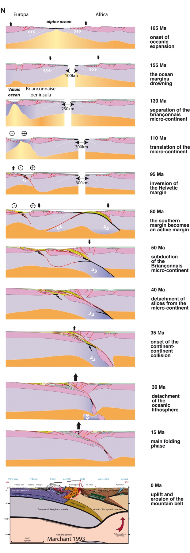 The following reconstructed cross-sections demonstrate the geodynamic evolution of the region beginning with the opening of the Alpine Ocean 165 Ma ago. Together with corresponding plate reconstructions these cross-sections produce an efficient tool to understand the four dimensional evolution in the Alps.
The present day Alpine cross-section can be unfolded and rebuilt to its former configuration, before the folding resulting from the continental collision. As this unfolding progresses, a domain can be displaced laterally, disappearing from the cross-section. This is why a good model of plate movements is essential for the rebuilding of previously existing cross-sections.
The following series of diagrams (modified from Stampfli & Hochard 2009) recreate this Alpine scenario, from the opening of the Alpine Ocean 165 Ma ago to the present time. The red star symbolizes the position of the Val d’Hérens.
NB: As the entire Alpine Ocean is not visible on the top cross-sections the approximate width is indicated in kilometres
Between 155 and 130 Ma years ago the Briançonnais Peninsula detached from southern France and drifted with the Iberian plate - Spain, Portugal, Balearic Islands, Sardinia and Corsica – to form a new plate, and as a consequence opened the Valais-Pyrenees inlet. Situated between Sion and Evolène, this 150 km large peninsula was reduced tenfold by later alpine folding (reconstruction 130 Ma).
When the Alpine ocean ceased to widen around 120 Ma (at 1’05’’ on the film), the Valais Ocean begun a lateral displacement on its borders, and the Briançonnais Peninsula moved eastward.
When this displacement terminated 60 Ma ago, Alpine folding and shortening began. This is depicted 50 Ma ago with the southward subduction of the Briançonnais Peninsula under the African plate.
A further fifty Ma were necessary to build the Alpine chain to today's landscape. Between 40 Ma ago and the present day, a hundred kilometres of European continental crust were subducted under the African plate. As a result, the Alpine lithosphere reaches a thickness of 120 kilometres. In Valais the Earth's crust alone can reach 50 km of thickness. This excess of material less dense than the Earth's mantle explains the elevation of the Alpine relief.


 |
 |
 |
 |


+41 (0) 27 283 40 00
Place du Clos Lombard 6
1983 Evolène